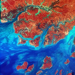
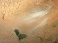
商用無料の写真検索さん


silt

タグをコピペすると、ブログなどにカンタン貼り付けできます。

各画像のライセンスに従って利用してください。被写体の肖像権、商標・意匠登録等にご注意ください。

詳しくはクリエイティブ・コモンズ・ライセンスの利用についてをご覧ください。

Low water 2
Low water 2
by forkcandles

クリエイティブ・コモンズ 表示-改変禁止 2.1

silt hug
silt hug
by Genista

クリエイティブ・コモンズ 表示-継承 2.1

Angular Cenozoic unconformity
by Dietmar Down Under

クリエイティブ・コモンズ 表示 2.1


Northrop N-3PB ‘320 / U’
by HawkeyeUK

クリエイティブ・コモンズ 表示-継承 2.1

Rani Ki Vav, Patan, Gujarat
by Ninara

クリエイティブ・コモンズ 表示 2.1

Godmanchester to St Ives 111: Hemingford Grey Meadow
by Peter O'Connor aka anemoneprojectors

クリエイティブ・コモンズ 表示-継承 2.1


Hallett Cove Conservation Park. Geologically interesting landscape. Formed by glaciation and erosional forces. Features here formed in the Permian era about 290 million years ago and more recent erosion.
by denisbin

クリエイティブ・コモンズ 表示-改変禁止 2.1

Long Dusty Road
Long Dusty Road
by Jocey K

クリエイティブ・コモンズ 表示-継承 2.1

Vangoner Shobdo Shuni
by sytoha / Syed Touhid Hassan

クリエイティブ・コモンズ 表示 2.1


Guinea-Bissau
Guinea-Bissau
by NASA Goddard Photo and Video

クリエイティブ・コモンズ 表示 2.1

Johnston Canyon, Banff NP Alberta Canada
by JonoMueller

クリエイティブ・コモンズ 表示 2.1

A QUICK WALK AROUND THE TOWN [MIDLETON WITH ONE L]-119195
by infomatique

クリエイティブ・コモンズ 表示-継承 2.1


On a Beautiful Morning in Central
by Jocey K

クリエイティブ・コモンズ 表示-継承 2.1

Great Scene
Great Scene
by Jocey K

クリエイティブ・コモンズ 表示-継承 2.1

Su Causeway
Su Causeway
by D-Stanley

クリエイティブ・コモンズ 表示 2.1


Nodi Vanga Manusher Vangoner Sathe Bosobas
by sytoha / Syed Touhid Hassan

クリエイティブ・コモンズ 表示 2.1

Langhorne Creek. The local limestone Anglican Church. Built in 1929. Sir Lancelot Stirling laid the foundation stone.
by denisbin

クリエイティブ・コモンズ 表示-改変禁止 2.1

Nepali woman washes clothes in the Babai River
by पानी परयोजना

クリエイティブ・コモンズ 表示-改変禁止 2.1


Rani Ki Vav, Patan, Gujarat
by Ninara

クリエイティブ・コモンズ 表示 2.1

Evidence of flash flooding - Matthew Flinders Hotel
by avlxyz

クリエイティブ・コモンズ 表示-継承 2.1

Colyford Devon
Colyford Devon
by jmc4 - Church Explorer

クリエイティブ・コモンズ 表示-継承 2.1


Pair of silt scoops
Pair of silt scoops
by Powerhouse Museum Collection

No known copyright restrictions(著作権制限なし)

Ancient River Gravels
by Jocey K

クリエイティブ・コモンズ 表示-継承 2.1

Mud and silt cover a wide area
by OregonDOT

クリエイティブ・コモンズ 表示 2.1


PINARA   Ancient Lycian City.  Fethiye/Turkey.  Rock Tombs
PINARA Ancient Lycian City. Fethiye/Turkey. Rock Tombs
by Feridun F. Alkaya

クリエイティブ・コモンズ 表示-継承 2.1

Berries and Clay
Berries and Clay
by Jocey K

クリエイティブ・コモンズ 表示-継承 2.1

Mississippi River in Iowa, after the flood
by kevin dooley

クリエイティブ・コモンズ 表示 2.1


Nigeria
Nigeria
by NASA Goddard Photo and Video

クリエイティブ・コモンズ 表示 2.1

palm wine silt, mmmm
by rickbradley

クリエイティブ・コモンズ 表示 2.1

Fantasy Canyon
Fantasy Canyon
by RuggyBearLA

クリエイティブ・コモンズ 表示 2.1


Workman with silt scoops
by Powerhouse Museum Collection

No known copyright restrictions(著作権制限なし)

Bembidion (Peryphus) bruxellense Wesmael, 1835
by urjsa

クリエイティブ・コモンズ 表示-継承 2.1

GRAND CANAL DOCK AREA [THE THREE LOCKS AT THE ENTRANCE FROM THE RIVER LIFFEY]-131381
by infomatique

クリエイティブ・コモンズ 表示-継承 2.1


The Banjo Pier. Nikon D3100. DSC_0376.
by Robert.Pittman

クリエイティブ・コモンズ 表示-改変禁止 2.1

palm wine silt, mmmm
by rickbradley

クリエイティブ・コモンズ 表示 2.1

Silted Pond
Silted Pond
by Ozzy Delaney

クリエイティブ・コモンズ 表示 2.1


Still some water, silt amd mud flowing
by OregonDOT

クリエイティブ・コモンズ 表示 2.1

Hallett Cove. Adelaide. Lone fisherman on the rocks. View from Hallett Cove Conservation Park.
by denisbin

クリエイティブ・コモンズ 表示-改変禁止 2.1

Woolley's Pit
Woolley's Pit
by D-Stanley

クリエイティブ・コモンズ 表示 2.1


Silt (less than 0.0625 millimeter)
by James St. John

クリエイティブ・コモンズ 表示 2.1

The Tip, Point Pelee National Park, Leamington, Ontario, Canada
by Ken Lund

クリエイティブ・コモンズ 表示-継承 2.1

Squamish River silt in Howe Sound
by Ruth and Dave

クリエイティブ・コモンズ 表示 2.1


The Anacostia River, Brown With Silt, April 1973
by U.S. National Archives

No known copyright restrictions(著作権制限なし)

Marsh Boardwalk, Point Pelee National Park, Leamington, Ontario, Canada
by Ken Lund

クリエイティブ・コモンズ 表示-継承 2.1

Silt Screen
Silt Screen
by BeachiKeen

クリエイティブ・コモンズ 表示 2.1


Small Powerboat On Potomac River Above Mt. Vernon Churns Up Silt, April 1973
by U.S. National Archives

No known copyright restrictions(著作権制限なし)

Not Google Street View
by Axel Bührmann

クリエイティブ・コモンズ 表示 2.1

Milang. Photo from the Milang railway station museum of Landseers big warehouses during the river boat trading days of the 19th century in Milang. Now all these buildings are gone.
by denisbin

クリエイティブ・コモンズ 表示-改変禁止 2.1


One of the Silty Twin Brooks of Twinbrook
by John Brighenti

クリエイティブ・コモンズ 表示 2.1

Langhorne Creek. The Bridge Hotel. On the banks of the Bremer River. Licensed in 1850 and still trading.
by denisbin

クリエイティブ・コモンズ 表示-改変禁止 2.1

Marsh Boardwalk, Point Pelee National Park, Leamington, Ontario, Canada
by Ken Lund

クリエイティブ・コモンズ 表示-継承 2.1


The Southernmost Tip of Canada, Point Pelee National Park, Leamington, Ontario, Canada
by Ken Lund

クリエイティブ・コモンズ 表示-継承 2.1

Langhorne Creek. The coaching stables and carriage shed. The coach companies changed their horses here on the trip from Adelaide to Wellington on the Murray River. Built around 1870.
by denisbin

クリエイティブ・コモンズ 表示-改変禁止 2.1

Marsh Boardwalk, Point Pelee National Park, Leamington, Ontario, Canada
by Ken Lund

クリエイティブ・コモンズ 表示-継承 2.1


Langhorne Creek. The Odd Fellows Hall. Built 1870. Used for public meetings until the Soldiers Memorial Hall opened in 1934. Also used for showing movies.
by denisbin

クリエイティブ・コモンズ 表示-改変禁止 2.1

The Tip, Point Pelee National Park, Leamington, Ontario, Canada
by Ken Lund

クリエイティブ・コモンズ 表示-継承 2.1

GRAND CANAL DOCK AREA [THE THREE LOCKS AT THE ENTRANCE FROM THE RIVER LIFFEY]-131383
by infomatique

クリエイティブ・コモンズ 表示-継承 2.1


Hallett Cove Conservation Park. View of St Vincents Gulf from  the Sugar Loaf named because of its shape.  Formed by glaciation and erosional forces.
Hallett Cove Conservation Park. View of St Vincents Gulf from the Sugar Loaf named because of its shape. Formed by glaciation and erosional forces.
by denisbin

クリエイティブ・コモンズ 表示-改変禁止 2.1

Hallett Cove Conservation. The Amphitheatre. Formed as a glacial melt water lake about 290 million years ago and then later eroded.
by denisbin

クリエイティブ・コモンズ 表示-改変禁止 2.1

Walpeup. This red brick Catholic Church is now unused and in disrepair. it was completed in 1921 and is the oldest church in the Murrayville to Ouyen districts.
by denisbin

クリエイティブ・コモンズ 表示-改変禁止 2.1


121件~180件 (全 4,022件)

(C)名入れギフト.com