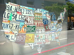
商用無料の写真検索さん


map

タグをコピペすると、ブログなどにカンタン貼り付けできます。

各画像のライセンスに従って利用してください。被写体の肖像権、商標・意匠登録等にご注意ください。

詳しくはクリエイティブ・コモンズ・ライセンスの利用についてをご覧ください。

Metropolitan Area Oakland California: Location of Oakland Business District in Relation to Business Districts of Other Cities (1947)
by Erica _ Fischer

クリエイティブ・コモンズ 表示 2.1

Hambantota
Hambantota
by Sarvodaya Sri Lanka

クリエイティブ・コモンズ 表示 2.1

groads-v1-global
groads-v1-global
by SEDACMaps

クリエイティブ・コモンズ 表示 2.1


MAP
MAP
by mmcanellas

クリエイティブ・コモンズ 表示 2.1

Flights in 2011, 33 segments, 94487 miles in total
by Jun Seita

クリエイティブ・コモンズ 表示 2.1

Grand Theft Auto: Chinatown Wars
by Gustavo da Cunha Pimenta

クリエイティブ・コモンズ 表示-継承 2.1


Location of Proposed Passenger Terminals, Oakland, California (1947)
by Erica _ Fischer

クリエイティブ・コモンズ 表示 2.1

12 Hour Vehicle Cordon Count Comparison of 1934-1937 and 1946, the Central Business District of Oakland California (1947)
by Erica _ Fischer

クリエイティブ・コモンズ 表示 2.1

M440-1878
M440-1878
by Community Archives of Belleville & Hastings County

No known copyright restrictions(著作権制限なし)


M430-2041
M430-2041
by Community Archives of Belleville & Hastings County

No known copyright restrictions(著作権制限なし)

MongRogerMap.JPG
MongRogerMap.JPG
by jrubinic

クリエイティブ・コモンズ 表示 2.1

El Retiro satelital 1
by jorgeandresem

クリエイティブ・コモンズ 表示 2.1


map
map
by Sustainable Economies Law Center

クリエイティブ・コモンズ 表示-継承 2.1

Richmond Boulevard Freeway (Oakland, 1947)
by Erica _ Fischer

クリエイティブ・コモンズ 表示 2.1

M430-1847
M430-1847
by Community Archives of Belleville & Hastings County

No known copyright restrictions(著作権制限なし)


MAP
MAP
by mmcanellas

クリエイティブ・コモンズ 表示 2.1

M440-1841
M440-1841
by Community Archives of Belleville & Hastings County

No known copyright restrictions(著作権制限なし)

2011_1_11_0_51_73348
2011_1_11_0_51_73348
by the pain of fleeting joy

クリエイティブ・コモンズ 表示-継承 2.1


M430-1869
M430-1869
by Community Archives of Belleville & Hastings County

No known copyright restrictions(著作権制限なし)

DonbasENG_target-hromadas_updated
by UNDP Ukraine

クリエイティブ・コモンズ 表示-改変禁止 2.1

Map
Map
by jasonippolito

クリエイティブ・コモンズ 表示 2.1


2012_1_22_47_0_49535
2012_1_22_47_0_49535
by the pain of fleeting joy

クリエイティブ・コモンズ 表示-継承 2.1

M430-1939
M430-1939
by Community Archives of Belleville & Hastings County

No known copyright restrictions(著作権制限なし)

Current Spill as of May 16 (NGA) IM
by lagohsep

クリエイティブ・コモンズ 表示-継承 2.1


Map of windsor in blue tiles
by Matt From London

クリエイティブ・コモンズ 表示 2.1

May18IM 0600
May18IM 0600
by lagohsep

クリエイティブ・コモンズ 表示-継承 2.1

my way to work
my way to work
by Daveybot

クリエイティブ・コモンズ 表示 2.1


Map
Map
by dave_stone

クリエイティブ・コモンズ 表示 2.1

IMG_3274
IMG_3274
by majcher

クリエイティブ・コモンズ 表示-継承 2.1


by half alive - soo zzzz

クリエイティブ・コモンズ 表示-改変禁止 2.1


map
map
by yearofthebird

クリエイティブ・コモンズ 表示 2.1

263
263
by grotos

クリエイティブ・コモンズ 表示 2.1

Me sorting our maps out
by andrew_j_w

クリエイティブ・コモンズ 表示-継承 2.1


Locmap-quadraisland
Locmap-quadraisland
by pfly

クリエイティブ・コモンズ 表示-継承 2.1

中華航空 空中巴士 A340-300 座艙配置圖.jpg
by 準建築人手札網站 Forgemind ArchiMedia

クリエイティブ・コモンズ 表示 2.1

2012_1_19_41_49_51898
2012_1_19_41_49_51898
by the pain of fleeting joy

クリエイティブ・コモンズ 表示-継承 2.1


Locmap-RosarioStrait
by pfly

クリエイティブ・コモンズ 表示-継承 2.1

Virtual Fairfax: Imagery
by fairfaxcounty

クリエイティブ・コモンズ 表示-改変禁止 2.1

Atlanta chastain path bike map
by 7263255

クリエイティブ・コモンズ 表示-継承 2.1


map of Toyama new port
by tsuda

クリエイティブ・コモンズ 表示-継承 2.1

Locmap-BanksIsland
Locmap-BanksIsland
by pfly

クリエイティブ・コモンズ 表示-継承 2.1

Locmap-CorderoChannel
by pfly

クリエイティブ・コモンズ 表示-継承 2.1


paul Revere's ride map1
by jimmie-quickity

クリエイティブ・コモンズ 表示-継承 2.1

Araschnia levana
Araschnia levana
by xulescu_g

クリエイティブ・コモンズ 表示-継承 2.1

Grove-Shafter Freeway and Richmond Boulevard Freeway (Oakland, 1955)
by Erica _ Fischer

クリエイティブ・コモンズ 表示 2.1


Ashby Freeway Alternative B (1951)
by Erica _ Fischer

クリエイティブ・コモンズ 表示 2.1

May 18 1800IM
May 18 1800IM
by lagohsep

クリエイティブ・コモンズ 表示-継承 2.1

May 18 1800BM
May 18 1800BM
by lagohsep

クリエイティブ・コモンズ 表示-継承 2.1


清二京十八省疆域全圖 - 26 雲南全圖.jpg
by 準建築人手札網站 Forgemind ArchiMedia

クリエイティブ・コモンズ 表示 2.1

Locmap-CortesIsland
Locmap-CortesIsland
by pfly

クリエイティブ・コモンズ 表示-継承 2.1

Map
Map
by Михал Орела

クリエイティブ・コモンズ 表示 2.1


State map of USA
State map of USA
by Kevin Hutchinson

クリエイティブ・コモンズ 表示 2.1

Locmap-StuartIsland
Locmap-StuartIsland
by pfly

クリエイティブ・コモンズ 表示-継承 2.1

MAPES
MAPES
by Shht!

クリエイティブ・コモンズ 表示 2.1


Locmap-SonoraIsland
Locmap-SonoraIsland
by pfly

クリエイティブ・コモンズ 表示-継承 2.1

Map of Hokkaido, Japan
by Mennonite Church USA Archives

No known copyright restrictions(著作権制限なし)

Map
Map
by Beige Alert

クリエイティブ・コモンズ 表示 2.1


Map
Map
by Alastair Rae

クリエイティブ・コモンズ 表示-継承 2.1

Oakland pedestrian volumes, 1937
by Erica _ Fischer

クリエイティブ・コモンズ 表示 2.1

Street Widths and Traffic Lanes in the Central Business District of Oakland California (1947)
by Erica _ Fischer

クリエイティブ・コモンズ 表示 2.1


2,341件~2,400件 (全 121,174件)

(C)名入れギフト.com