
digitalelevationmodel
タグをコピペすると、ブログなどにカンタン貼り付けできます。
各画像のライセンスに従って利用してください。被写体の肖像権、商標・意匠登録等にご注意ください。
詳しくはクリエイティブ・コモンズ・ライセンスの利用についてをご覧ください。


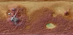
A Living Mars: A conception of an ancient and/or future Mars, flush with oceans, clouds and life.
by Kevin M. Gill
by Kevin M. Gill


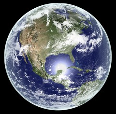
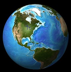
Earth - Global Elevation Model with Satellite Imagery (Version 6)
by Kevin M. Gill
by Kevin M. Gill

Earth - Global Elevation Model with Satellite Imagery (Version 5)
by Kevin M. Gill
by Kevin M. Gill

Earth - Global Elevation Model with Satellite Imagery (Version 4)
by Kevin M. Gill
by Kevin M. Gill

Earth - Global Elevation Model with Satellite Imagery (Version 3)
by Kevin M. Gill
by Kevin M. Gill
Earth - Global Elevation Model with Satellite Imagery (Version 2)
by Kevin M. Gill
by Kevin M. Gill


SRTM version 1 elevations for the San Francisco Bay Area
by Erica _ Fischer
by Erica _ Fischer

SRTM version 2.1 elevations for the San Francisco Bay Area
by Erica _ Fischer
by Erica _ Fischer


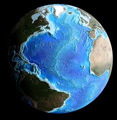


Global Bathymetry DEM With Satellite Landmass (Version 2, Globe)
by Kevin M. Gill
by Kevin M. Gill

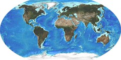
Global Bathymetry DEM With Satellite Landmass (Version 2)
by Kevin M. Gill
by Kevin M. Gill


1件~60件 (全 87件)